GetYourGuide8 hours
Nature· Whole island
Gran Canaria: The Red Canyon Tour with Local Food Tasting
4.7 (324)
from €115Check availability
Summit and natureAgüimes · tuff canyon
Barranco de las Vacas is a narrow canyon of volcanic tuff beside the GC-550 road, between Agüimes and Temisas. No permit or ticket is needed; the hard part is parking, because there is only room on the verge.
39 min 33 km · by car, no traffic
Updated 15 October 2026Facts checked against official sourcesContains affiliate links
3 options · Prices checked on 15 October 2026
Nothing matches that combination. Remove a filter.
GetYourGuide8 hours
Nature· Whole island
4.7 (324)
from €115Check availability
GetYourGuide7.5 hours
Nature· Whole island
5.0 (131)
from €95Check availability
GetYourGuide3 hours
Nature· Las Palmas and the north
No reviews yet
from €60Check availability
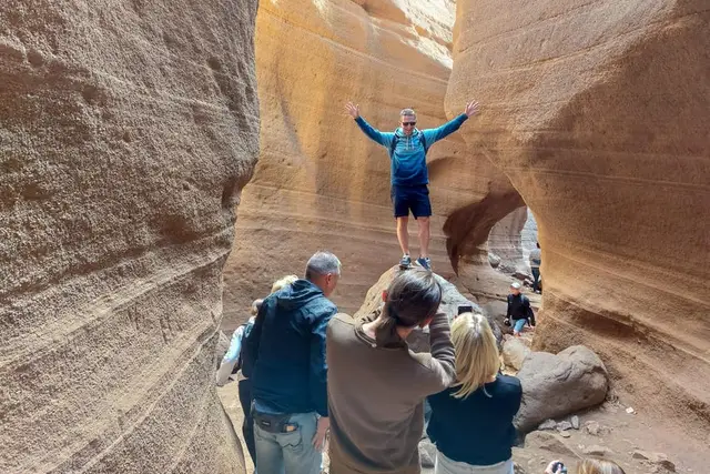
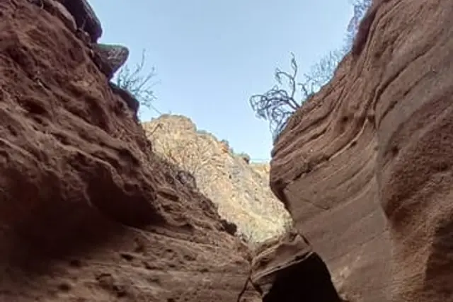
Barranco de las Vacas is the canyon with red and yellow walls that turns up in so many Gran Canaria photos under the name "Red Canyon". It lies in the municipality of Agüimes, beside the GC-550 road that climbs to Temisas, and it is much smaller than the photos suggest: a gorge a few hundred metres long, with walls 10 to 15 m high and stretches only one or two metres wide. It is still well worth the stop.
One point to clear up before going any further: the "Red Canyon" is not the Barranco de Guayadeque. Guayadeque is a different ravine, much bigger, with cave houses and restaurants cut into the rock; it is close by and combines very well, and we cover it further down.
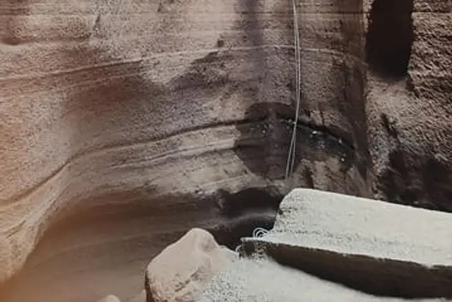
On the Canary Islands a barranco is a ravine or dry riverbed carved by water. This one is a narrow cleft in volcanic tuff, a soft rock made of compacted ash, which water has polished into curves and coloured layers running from yellow to red. That is why you see those wavy walls that look as if they were drawn by hand.
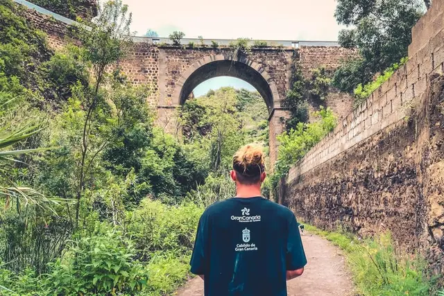
Strictly speaking, the narrow stretch everyone photographs is the Barranco de Barafonso; "de las Vacas" is the name of the lower part. It runs beneath a stone road bridge built in 1933, which is the best landmark for finding your way.
When it is dry you can walk it for a few hundred metres. Allow an unhurried hour and a half to go in, take photos and come out. It is not accessible for wheelchairs or pushchairs.
This is the first mistake almost everybody makes: if you type "Barranco de las Vacas" into the sat nav, it may send you to another point along the ravine, far from the canyon. Type "Barranco de Barafonso" or "Acceso al barranco de las Vacas", or simply enter the stone bridge on the GC-550 between Agüimes and Temisas.
From Playa del Inglés it takes about 40 minutes; from Maspalomas a little longer; from Puerto Rico or Puerto de Mogán, close to an hour; and from Las Palmas, about 50 minutes.
| Playa del Inglés | Maspalomas / Meloneras | Puerto Rico / Amadores | Puerto de Mogán | Las Palmas | |
|---|---|---|---|---|---|
| Barranco de las Vacas | 39 min33 km | 43 min39 km | 58 min49 km | 58 min56 km | 49 min45 km |
| Barranco de Guayadeque | 40 min36 km | 44 min41 km | 59 min51 km | 59 min58 km | 44 min39 km |
| Agüimes | 30 min30 km | 34 min35 km | 49 min45 km | 49 min52 km | 37 min36 km |
Free-flow driving time calculated with OSRM on OpenStreetMap. In summer and at rush hour allow 20–30 % more, plus time to park.
There is no car park. Only a handful of cars fit in the widened verge of the GC-550, beside the main access point at the upper end. By mid-morning it is usually full, and the road is narrow: do not leave your car on a bend or sticking out into the lane. If it is full, turn round and come back later.
How to visit on your own
It is possible, but not easy. Global's line 34 (Doctoral – Agüimes – Cruce de los Corralillos – Temisas – San Bartolomé de Tirajana) runs along this road; guagua is the local word for bus. From Doctoral towards San Bartolomé it leaves Monday to Friday at 07:15, 08:00, 12:00, 13:25, 14:00, 16:30 and 19:30; on Saturdays and public holidays at 08:00, 12:00, 16:30 and 19:30. In the other direction, it leaves San Bartolomé at 06:40, 09:30, 14:40 and 18:00.
There is no confirmed stop by the bridge. One option people use is to get off at Cruce de los Corralillos (the GC-551/GC-550 junction) and walk about 3 km along the road, which has no pavement. Check the current timetable on the line 34 page and ask the driver where best to get off.
No. At present there is no booking, ticket, opening hours or permit: neither Agüimes town council nor the Cabildo (island council) regulates access. It is an open space beside the road. If it is ever regulated, as happened with Roque Nublo, you will see it announced by the town council or the Cabildo before you come.
What we do ask is common sense: this is soft rock and it wears away. Do not carve initials into the walls, do not climb along the edges, and take your rubbish with you.
The canyon is narrow and around midday it fills up: groups taking photos, people queuing for the same wall and the verge packed solid. The two good windows are before 09:30 and late afternoon. There is a reason the small-group tours arrive early.
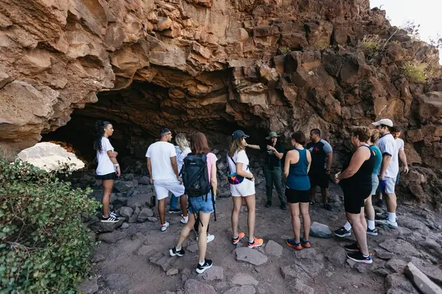
If you have no car or would rather not gamble on the verge, a tour solves the parking and adds stops you would not make on your own. There are two kinds: the short small-group trip, focused on the canyon and some caves, and the full-day "Red Canyon" excursion with food.
The tours we would choose
1
For anyone who wants the canyon almost to themselves
Sky Rebels: about 4 h, maximum 6 people with two local guides, early pick-up in Maspalomas, caves and Temisas. From €74 on GetYourGuide.
GetYourGuide4 hours
Nature· Whole island
4.9 (188)
from €74Check availability
2
For a day of adventure with a picnic
A 7.5 h route through the "red gorge", a cave and an oasis, with a picnic; rated 5.0 out of 5 from more than 130 reviews.
GetYourGuide7.5 hours
Nature· Whole island
5.0 (131)
from €95Check availability
3
To see the whole south-east in one day
The "Red Canyon" with tasting: canyon, viewpoint and fortress, plus the Arinaga coast. More than 300 reviews.
GetYourGuide8 hours
Nature· Whole island
4.7 (324)
from €115Check availability
The Sky Rebels trip costs €65 per person on its own website, with pick-up in Maspalomas (Faro bus station at 08:10, Campo Internacional at 08:15), against €74 on GetYourGuide; the company itself says it raises its prices on the platforms to cover the commission. As a private trip it costs €330 per group from the Maspalomas area and €390 from the Mogán area.
Two points from the small print: "reserve now, pay later" bookings made through platforms are cancelled automatically, so pay when you book; and if you cancel more than 48 hours ahead, you are refunded minus a 10 % fee. More in our Sky Rebels review.
The "Red Canyon with local food tasting" tour visits the Mirador del Guriete (Santa Lucía), the Fortaleza de Ansite, Barranco de las Vacas and Arinaga. The walk up to the Fortaleza is short: about 650 m with 40 m of ascent. It is the same product on all three platforms:
| Platform | Product | Rating | Price | Where |
|---|---|---|---|---|
| Headout | Gran Canaria: The Red Canyon Tour with Local Food Tasting | — | €103.50 Best price | See on Headout |
| GetYourGuide | Gran Canaria: The Red Canyon Tour with Local Food Tasting | 4.7 (324) | €115 | See on GetYourGuide |
| Tiqets | Gran Canaria: Guided Red Canyon Tour + Transfers + Local Products Tasting | 5.0 (1) | €115 | See on Tiqets |
Adult price, checked on 15 October 2026. Platforms change prices daily: confirm before you pay.
Today Headout is the cheapest, from €103.50, against €115 on GetYourGuide and Tiqets. The saving is worth it if you do not mind that it has no reviews on Headout yet; if you prefer to reserve now and pay later, go with GetYourGuide. If what interests you is the south of the island in general, also look at the jeep safaris, which cover Santa Lucía, Ansite and Fataga.
GetYourGuide4 hours
Nature· Whole island
4.9 (188)
from €74Check availability
GetYourGuide8 hours
Nature· Whole island
4.7 (324)
from €115Check availability
GetYourGuide7.5 hours
Nature· Whole island
5.0 (131)
from €95Check availability
GetYourGuide3 hours
Nature· Las Palmas and the north
No reviews yet
from €60Check availability
See everything on GetYourGuide →Prices checked on 15 October 2026
You will also see a canyoning trip with abseiling in Barranco de las Vacas (from €60, 3 h). It is new and has no reviews yet; if canyoning in general appeals, see the kayak, coasteering and canyoning page.
With half a day you can link the canyon with three more stops:
If you go on a Friday, there is a farmers' market in Arinaga, on the coast. More route ideas in the day trips and the places to visit in Gran Canaria.
On the GC-550 road, between Agüimes and Temisas, in the south-east of Gran Canaria. The canyon runs under a stone bridge dating from 1933. In the sat nav, search for "Barranco de Barafonso".
By car, about 40–45 minutes on the GC-1 towards Agüimes and then the GC-550. Without a car, the practical option is a tour with pick-up, such as the Sky Rebels trip from Faro de Maspalomas.
There is no car park. There is only room for a few cars on the widened verge at the upper access point on the GC-550. Arrive before 09:30 or in the afternoon.
No. It is free, with no booking and no opening hours.
No. The "Red Canyon" of the tours is Barranco de las Vacas. Guayadeque is a different, bigger ravine with cave houses and restaurants, about 40 minutes from Playa del Inglés.
Global's line 34 runs along the GC-550, but there is no confirmed stop by the bridge; from Cruce de los Corralillos it is about 3 km on foot along the road.
Booking calendars The GetYourGuide and Tiqets calendars are loaded by those companies and may use cookies. This site uses no cookies or analytics of its own. More information